
I have made the drive to and from St. George, Utah along I-15 hundreds of times. Generally, I stop in Fillmore because its pretty much half way and makes for a good place to stretch you legs and top off on fuel and food. I’ve always looked at the mountains to the east and thought, “I wonder what roads are up there?” But I’ve never taken the time to find out.
Mid October that changed. One of my oldest friends, Spencer, who is generally the reason that I make that drive to St. George, and I decided to meet in the middle and do a little exploring and camping. The middle was Fillmore and the Pavant Range to the east.
Our meeting place in Fillmore was the old Territorial State House.
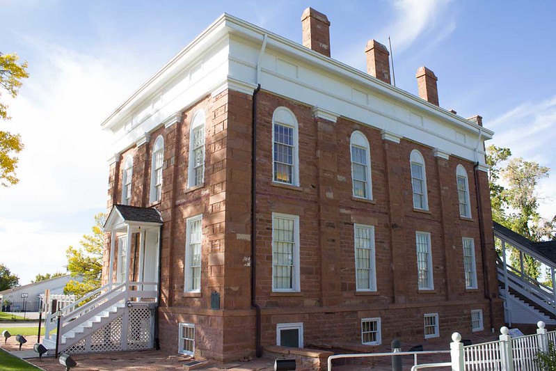
It’s easily been 20 years since the last time I went to the State House (god, that sad that I can actually remember 20 years ago…), so it was interesting to stop off at the museum again. In reality, though, nothing much had changed. An interesting, if trivial, piece of Utah history and I would recommend anyone going, but mostly pretty staid exhibits.
From the State House, we decided to grab a bite to eat before hitting the trail. Like so many small towns that have been bypassed by the freeway, there isn’t much left on Main Street, which is really sad. But there was one burger joint called Cluff’s Car Hop, and it’s fantastic. In all these years blazing past Fillmore, I never came here. Totally worth it.
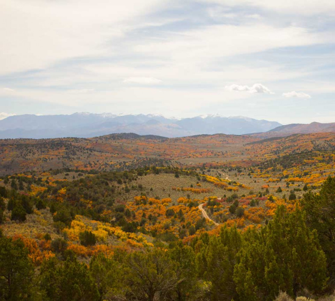
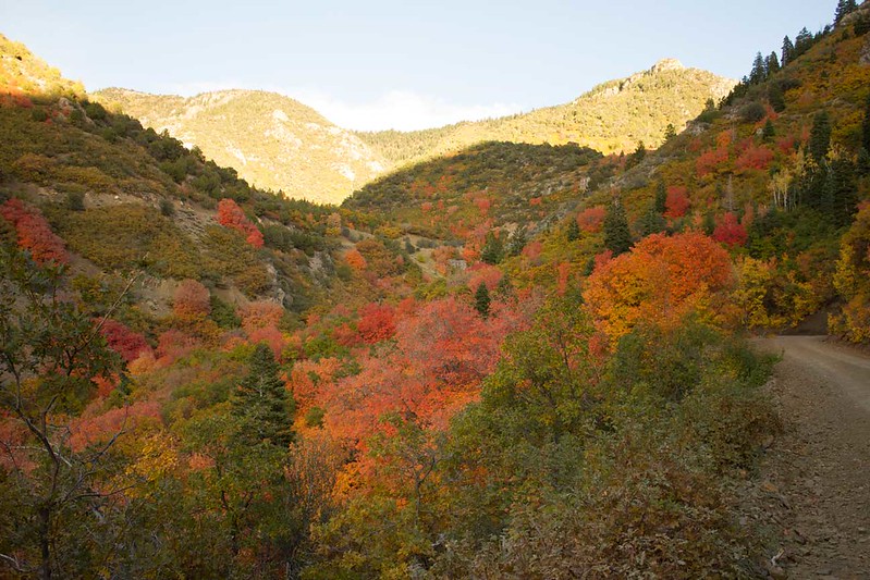
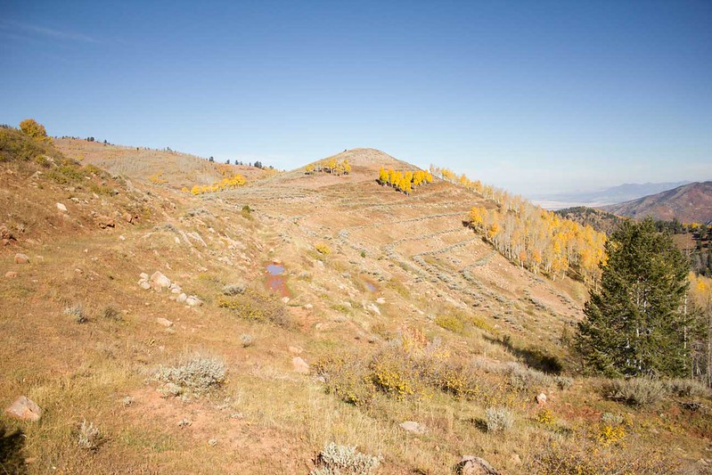
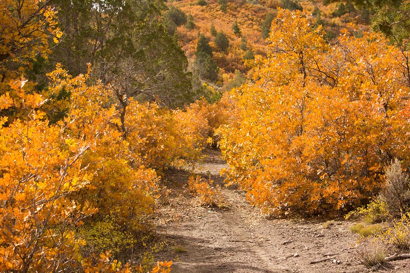
After enjoying a delicious cheese burger and fresh raspberry shake, it was time to leave pavement and head east into the Pavant Range. We decided to start our journey along the Chalk Creek Canyon road. A fairly major gravel and dirt trail that winds its way higher and higher into the mountains offering some stunning views of the valley below and magnificent fall colors.
As we climbed and climbed it became apparent that we were not going to be finding any flat areas to camp until we reached the summit. So we powered on until the light started to fade a bit and we reached a cattle corral at the top. It was flat, already had a fire ring, but… was next to a cattle corral and the associated material. There were spur roads heading off in either direction so we split up to find a more suitable spot.
I wandered an aspen shrouded trail called “Bear Hollow”. With leaves so thick on the road, it seemed like I was the first traveler into a forbidden land. But then, there about half a mile in was the perfect camp spot. Off the road a ways, guarded from the wind by tall aspens and low bushes, a flat spot with plenty of room for our two vehicles and a coupe of tents. Exactly the kind of spot you dream of. I radioed back up to Spence about the choice spot I had found, and he quickly headed back down.
We quickly staked our camp as the last rays of light departed and then stoked a roaring fire to sit around and enjoy for the rest of the night.
The next morning we woke with the sun. Well, Spencer did any way, the joyously thick canvas of my Skydome blocked the sun out until about 8:00, which was glorious! After a quick breaky we packed up and headed on out. We had no destination other than exploring and finding another suitable camping location for the evening. As we glided along the surprisingly smooth main road we saw a sign for “Hans Ridge” and a rocky ledge. Never one to turn down the chance to pop it into 4-Lo for some adventure, I turned off.
The trail led us along the afore mentioned ridge via a narrow two track, but not much more. When the trail finally squeezed itself down to ATV size, we stopped for a moment to enjoy the view and wax poetical about Jason Statham’s fine acting career.
After reflecting on such fine works as Safe and The Feather Men, we pulled out the trusty Benchmark Atlas and surveyed our surrounds. The next point on interest along the main road was called White Pine Point. Sounded like a logical place to head to.
As we wound our way up the mountain, I started to notice terracing leading up the peak. It reminded me of the anti-erosion terracing that you see in American Fork Canyon that was completed by the CCC. But my research thus far has not indicated that this was done at the same time.
Eventually we found our way to White Pine Peak, which is dominated by radio and cellular towers.
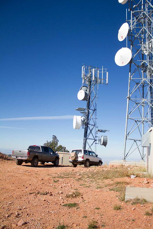
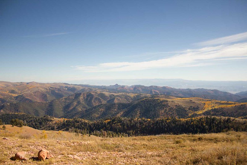
Which would explain why I had maximum cell signal all throughout the Pavant Range! So, while we sat there at 10,200 feet getting fried by various microwave signals, we also took in the absolutely spectacular views!
From here, Spencer and I ran into a problem. The roads were in great shape, and both of us are notoriously fast drivers. So where we reached at noon, was where we had planned to be by five. So we decided that rather than munch on ham and cheese sandwiches, we’d head into Richfield for lunch.
I’ve passed through Richfield a handful of times over the years, and I’ve always been amazed at how vibrant the little town feels. I think it’s in large part due to Snow College being there, which is good. I’m always saddened when I pass through a town that is well past its prime, like Fillmore. So finding a Main Street with life is always pleasant.
We parked in front of the post office, which proudly shows it’s cornerstone marked “1917” and began wandering. Our first stop was the Liquor Store. I had brought plenty of beer to help make the evenings by the fire go a little smoother, but Spencer has a slightly more sensitive pallet than I. So he bought himself some hard cider for the evening ahead. We then made our way up to the restaurant district. A whole two, right across the street from each other. One, the mainstay of Richfield, Little Wonder Café, is your classic Diner. In business for 70 some odd years, it’s definite stood the test of time. Our next option was the brand new Main Street Grille.
We decided to try out luck and give the Main Street Grille a try. Totally worth it. A delicious Ruben and some fish and chips were much more filling than the ham and cheese sitting in the fridge.
Our next order of business was to improve our communication set up. Spencer, not being a seasoned 4-wheeler, lacked a CB in his Dodge and we’d been relying on FRS radios. So we headed to the local Radio Shack and bought the bargain basement CB model. After setting this up and rolling out of town, we quickly learned why it was so cheap. While he could hear me fine, his transmissions sounded more like the adults from a Charley Brown cartoon. After fiddling with is a bit, Spencer decided he’d just deal with it for the time being.
It was time to head back into the mountains. We decided to tack southwest a bit on I-70 and head back into the Pavant Range just outside of Elsinore. It was about 3pm, so we wanted to find a nice camp spot and set up for some target shooting before it got to dark.
Looking at the maps, we decided to give Forest Road 496 a try.
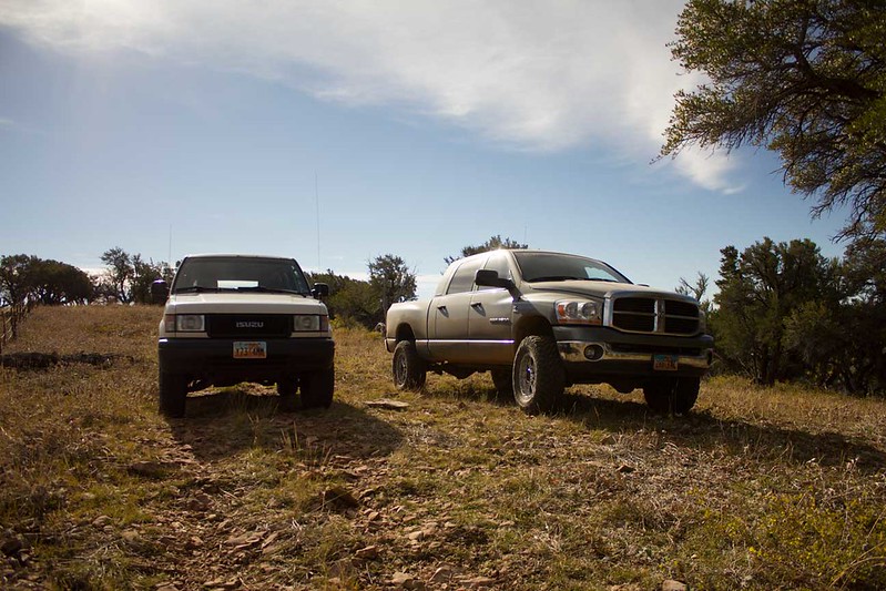
It was a spectacular two-track road with a few fun little spurs, that were often a bit of a tight fit for the Trooper, and subsequently the big Dodge!
After a few hours of poking our noses down every spur road looking for a suitable camp spot, we found one up on FR439 just a little ways away from Joseph Peak nestled beneath a grove of bright yellow aspen trees. We set up Spencer’s dueling tree and plinked away with our .22’s for a good long while.
That night was windy. Very windy. And it boded poorly for Sunday. As morning broke, cold weather and ominous looking clouds crowding the horizon greeted us. Our initial plan was to heads south and cross I-70 and head into the Tushar Mountains. But the brewing weather and Spencer’s general dislike of all things cold prompted us to change our plans and turn west for the desert.
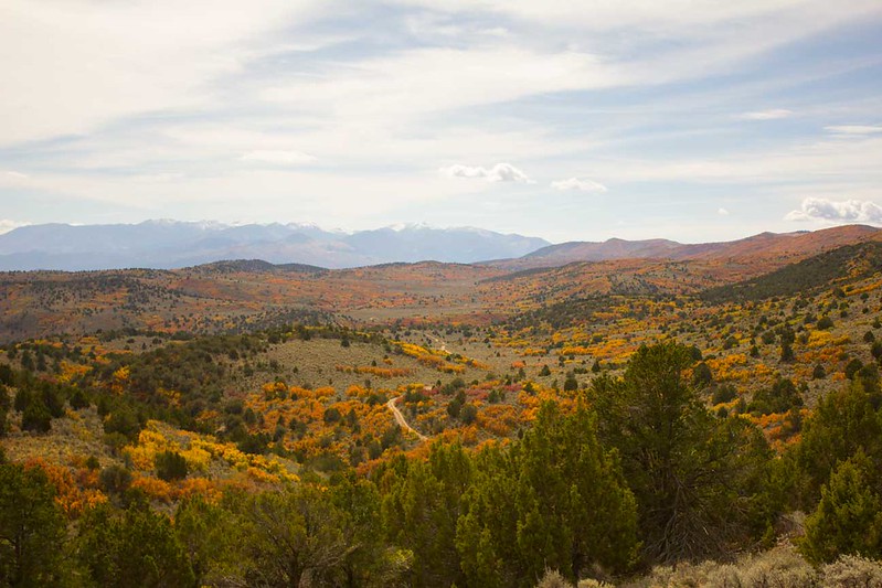
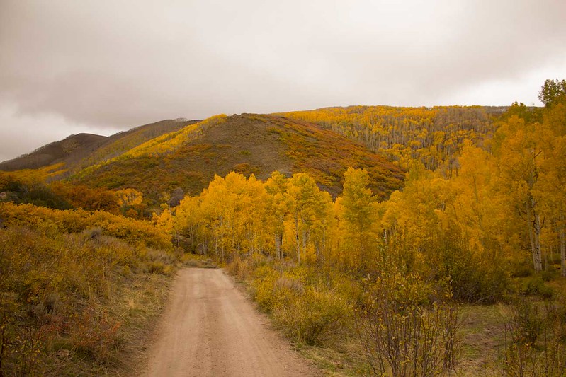
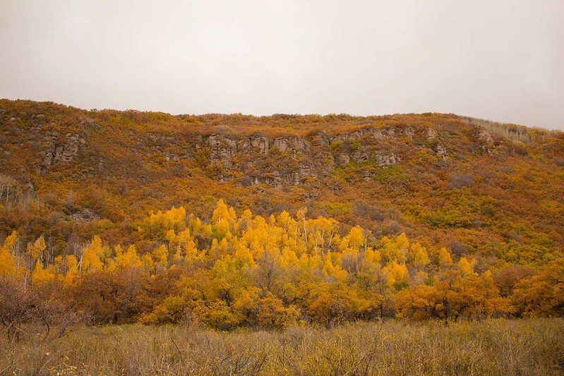
First, we made our way out of the Pavant Range towards Kanosh through the absolutely spectacular fall colors.
We made a quick stop in Meadow for gas and had some of the worst gas station coffee ever before we decided to make our way out to a place on the map called Clear Lake. As we passed through Flowell, we could see this long black strip on the horizon. Having never been out here before, neither of us were sure what it was. But as we got closer, we saw that it was a huge lava flow.
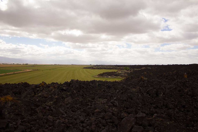
On the map, it’s simply referred to as “The Lava”, which was apt enough. Easily a quarter mile wide and several miles long, it was an impressive site to see with the farmland butting up against it.
After poking around on the lava for a minute, we continued towards Clear Lake, which really wasn’t much to talk about. A waterfowl management area, it reminded me of Fish Springs along the Pony Express Trail, but less grand.
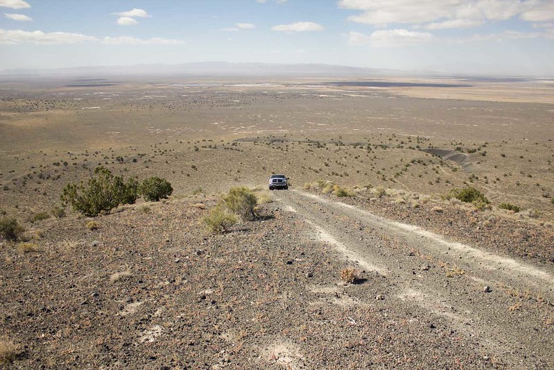
Being disappointed with Clear Lake, we again consulted the map and decided to head back to Fillmore. As we drove, ahead of us stood Pahvant Butte (yes, with an “h”), atop it I could make out structures that looked very familiar to me. Something I’d read about before, but I swore it was further west. So we detoured off the main road to head up the butte and check it out.
As we neared, I was positive that this was the structure I was thinking of, but first there appeared to be only one road getting up to it. A rather steep climb on loose gravel with a rough patch in the middle. I wasn’t phased, dropping the Trooper in 4-low and hitting the gas I abled up it with nary a wheel spin.
Spencer, on the other hand, had a bit of a struggle. Getting stuck in the middle and having to back down a bit before he could get the lumbering Dodge the entire way up.
And there we were, atop Pahvant Butte and one of the oddities of Utah.
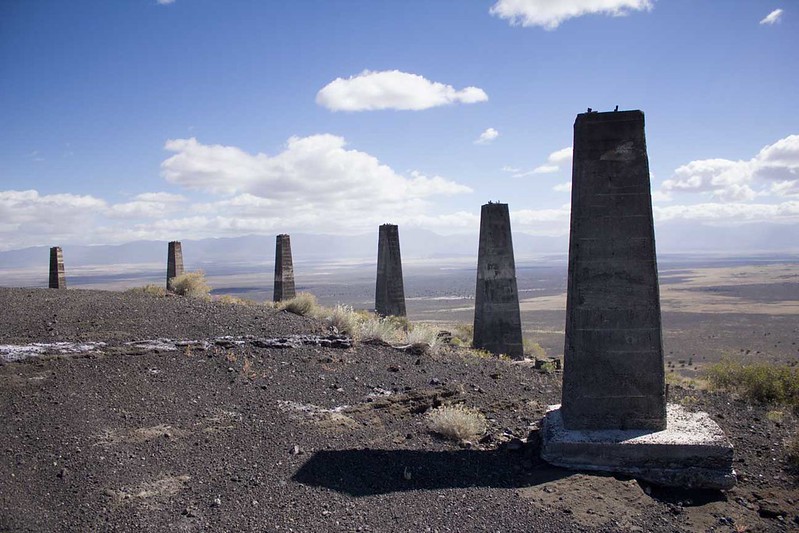
Back in the early 1920’s a gentleman by the name of A.H. Hood came to Millard County and proposed building a wind turbine power plant on the top of the butte. He managed to get some investors and construction began in 1923. It was never completed.
Supposedly the project went bankrupt and Hood was eventually convicted of mail fraud and sent to prison. As far as anyone has been able to find, there are no remaining photos, plans, or blueprints. So we can just wonder what it would have looked like.
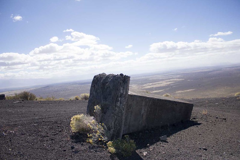
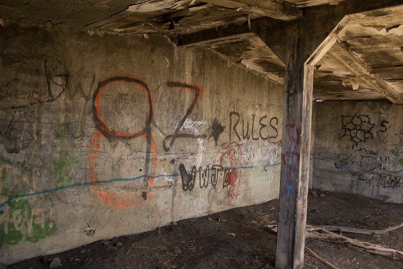
For having sat abandoned on the top of this windy butte for 91 years, it’s in remarkable condition. Only one tower has collapsed and the main building, which I assume would have held the generator, still stands.

And surprisingly, has very little graffiti. Likely due to it’s remoteness.
Just an odd, fascinating place. The type of place that you can only hide in the vast emptiness of the desert.
We poked around the very windy butte for a bit before we decided it was time to make our way back to the interstate and home. It turned out that the steep climb we had made was not the only way up. And on the other side of the butte was a road that had been cut in no doubt for the construction of the wind turbine. We ambled down that and then blasted along the desert roads until we connected with US 50 and ultimately I-15.
Spencer and I parted ways, him south to sunny St. George and me to less sunny Salt Lake. It was a great trip to go and explore a part of the state that so many of us just fly through to other points. It definitely merits further exploration on my part and I look forward to coming back!
